<h1>NVS-03: India's Strategic Leap in Navigation Technology and Its <a href="/article/how-india-s-5-point-maritime-trade-blueprint-is-redefining-global-shipping-a-complete-guide" title="How India’s 5‑Point Maritime Trade Blueprint Is Redefining Global Shipping – A Complete Guide" class="internal-link">Global</a> Impact</h1>
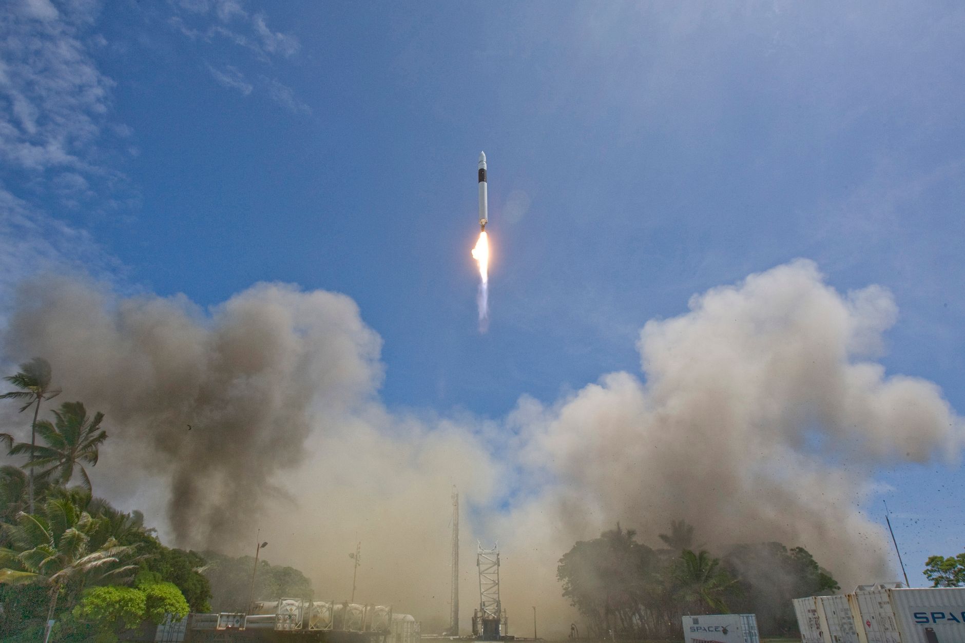
<p>India's space program has once again demonstrated its remarkable trajectory of self-reliance with the successful launch of the <b>NVS-03 navigation satellite</b>. This cutting-edge addition to the NavIC constellation represents more than just another milestone; it signifies India's growing prowess in precision navigation technology and its commitment to achieving strategic space autonomy. As global dependencies on satellite-based navigation systems intensify, the <b>NVS-03 launch</b> positions India as a formidable player in the international space economy, offering a robust alternative to Western-dominated systems like GPS.</p>
<p>The <b><a href="/article/innovation-success-stories-across-indian-industries-how-bold-ideas-transformed-the-market" title="Innovation Success Stories Across Indian Industries: How Bold Ideas Transformed the Market" class="internal-link">Indian</a> space technology</b> landscape has evolved dramatically over the past decade, with ISRO's achievements underscoring the nation's ability to develop indigenous capabilities that can compete globally. The <b>NVS-03 satellite</b> is not merely a technological marvel but a symbol of India's determination to reduce reliance on foreign navigation systems while providing enhanced services to its citizens and international partners alike.</p>
<figure class="my-8 overflow-hidden rounded-3xl shadow-xl">
<img src="https://images.pexels.com/photos/36782610/pexels-photo-36782610.jpeg?auto=compress&cs=tinysrgb&dpr=2&h=650&w=940" alt="NVS-03 satellite launch" class="w-full h-[400px] object-cover" />
</figure>
Advertisement
Loading partner content...
<h2>Historical Context: The Genesis of India's NavIC Program</h2>
<p>The journey toward establishing India's independent <b>navigation satellite system</b> began decades ago, driven by strategic imperatives and the need for reliable positioning services. The Indian Regional Navigation Satellite System, or IRNSS (later renamed NavIC), was conceived in the 1990s following the Kargil conflict when India realized its dependency on foreign GPS systems could compromise national security during critical operations.</p>
<p>Former ISRO Chairman A.P.J. Abdul Kalam played a pivotal role in advocating for an indigenous navigation system. His vision laid the foundation for what would become one of India's most ambitious space projects. The first IRNSS satellite was launched in 2013, marking the beginning of a new era in India's space capabilities.</p>
<blockquote>"NavIC is not just about navigation; it's about empowering every Indian citizen with technology that belongs to them," said former ISRO official S. Rathnam during the early phases of the program.</blockquote>
Advertisement
Loading partner content...
<p>Since then, the <b>NavIC satellite</b> constellation has expanded significantly, with each launch building upon previous successes. The <b>NVS-03 launch</b> continues this legacy, incorporating advanced technologies developed through years of research and development within India's thriving space ecosystem.</p>
<h3>Evolution Through Key Milestones</h3>
<ul>
<li><b>2013:</b> First IRNSS satellite launched</li>
<li><b>2016:</b> Full operational capability achieved with seven satellites</li>
<li><b>2018:</b> NavIC services opened for civilian use</li>
<li><b>2020:</b> Enhanced signal capabilities introduced</li>
<li><b>2024:</b> NVS-01 marked next-generation upgrades</li>
<li><b>2026:</b> <b>NVS-03 launch</b> sets new benchmarks in accuracy and coverage</li>
</ul>
<h2>Technical Specifications and Capabilities of NVS-03</h2>
<p>The <b>NVS-03 satellite</b> represents the latest advancement in India's <b>navigation satellite system</b>, featuring state-of-the-art payloads designed to deliver superior positioning accuracy across the Indian region and surrounding areas. Built using indigenous components wherever possible, the satellite reflects ISRO's commitment to fostering domestic manufacturing capabilities while maintaining world-class performance standards.</p>
Advertisement
Loading partner content...
<table border="1" cellpadding="8" cellspacing="0">
<tr><th>Specification</th><th>NVS-03 Details</th></tr>
<tr><td>Mass</td><td>~1,500 kg</td></tr>
<tr><td>Design Life</td><td>10+ years</td></tr>
<tr><td>Orbital Position</td><td>NavIC GEO slot</td></tr>
<tr><td>Signal Accuracy</td><td>Sub-meter level</td></tr>
<tr><td>Power Supply</td><td>Solar panels + batteries</td></tr>
<tr><td>Indigenous Content</td><td>~95%</td></tr>
</table>
<p>One of the standout features of <b>NVS-03</b> is its enhanced L5 band transmission, which provides improved signal quality particularly beneficial for aviation <a href="/article/demystifying-web3-how-decentralized-applications-are-reshaping-india-s-digital-future" title="Demystifying Web3: How Decentralized Applications Are Reshaping India's Digital Future" class="internal-link">applications</a> where safety-critical navigation demands ultra-high precision. Additionally, the satellite incorporates anti-jamming technologies that ensure secure communication even under adversarial conditions.</arg_value></p>
<p>ISRO officials have highlighted that the <b>NVS-03 launch</b> introduces several firsts including advanced atomic clocks sourced domestically and modular design principles allowing easier maintenance and upgrades throughout the satellite’s lifespan.</p>
<figure class="my-8 overflow-hidden rounded-3xl shadow-xl">
<img src="https://images.pexels.com/photos/30596262/pexels-photo-30596262.jpeg?auto=compress&cs=tinysrgb&dpr=2&h=650&w=940" alt="satellite technology visualization" class="w-full h-[400px] object-cover" />
</figure>
<h2>Strategic Implications: Paving the Way for Space Autonomy</h2>
Advertisement
Loading partner content...
<p>In an era where control over space-based assets translates directly into geopolitical influence, the <b>NVS-03 launch</b> strengthens India’s position as a leader in <b>strategic space autonomy</b>. By developing and deploying its own <b>navigation satellite system</b>, India ensures uninterrupted access to critical positioning services essential for defense operations, infrastructure management, and civilian applications.</p>
<p>This strategic independence becomes increasingly vital given recent global tensions affecting satellite communications and navigation networks. With <b>NVS-03</b> now part of the expanded NavIC constellation, India joins a select group of nations possessing fully autonomous regional navigation systems capable of supporting both military and commercial needs without external dependencies.</p>
<blockquote>"The <b>NVS-03 launch</b> exemplifies our unwavering commitment to building a self-reliant space program," remarked ISRO Chairman S. Somanath at the post-launch briefing. "It reaffirms India's place among the global elite in space technology."</blockquote>
<p>Beyond immediate strategic benefits, the project fosters innovation within India's private sector through supply chain participation and technology transfer initiatives. These efforts contribute directly to realizing Prime Minister Modi's vision of Atmanirbhar Bharat in the realm of space technology.</p>
<h3>Key Strategic Advantages</h3>
Advertisement
Loading partner content...
<ol>
<li><b>Enhanced Defense Readiness:</b> Secure, tamper-proof navigation signals for armed forces</li>
<li><b>Critical Infrastructure Support:</b> Reliable timing references for power grids, telecom networks</li>
<li><b>Economic Resilience:</b> Reduced exposure to disruptions in foreign satellite services</li>
<li><b>Technological Leadership:</b> Strengthened R&D capabilities driving future innovations</li>
</ol>
<h2>Comparative Analysis: NavIC vs Global Navigation Systems</h2>
<p>When compared with established global systems such as the U.S.-based GPS, Russia’s GLONASS, China’s BeiDou, and Europe’s Galileo, <b>India's NavIC</b> offers distinct advantages tailored specifically for regional requirements. While GPS covers global expanses, <b>NavIC satellite</b> systems focus intensively on the Indian Ocean region, delivering higher resolution and better signal penetration in challenging terrains like mountainous regions and urban canyons.</p>
<p>The <b>NVS-03 launch</b> further narrows performance gaps by introducing dual-frequency transmissions comparable to those found in mature global systems. However, unlike many foreign counterparts, <b>NavIC</b> remains freely accessible to all users—a principle deeply embedded in India’s approach to space governance emphasizing equitable access to technological resources.</p>
<table border="1" cellpadding="8" cellspacing="0">
<tr><th>System</th><th>Coverage Area</th><th>Accuracy Level</th><th>Signal Openness</th></tr>
<tr><td>GPS (USA)</td><td>Global</td><td>~3 meters</td><td>Encrypted military codes</td></tr>
<tr><td>GLONASS (Russia)</td><td>Global</td><td>~5 meters</td><td>Partially restricted</td></tr>
<tr><td>BeiDou (China)</td><td>Global</td><td>~2.5 meters</td><td>Limited openness</td></tr>
<tr><td>Galileo (EU)</td><td>Global</td><td>~1 meter</td><td>Open + encrypted options</td></tr>
<tr><td><b>NavIC (India)</b></td><td><b>Regional (Asia-Pacific)</b></td><td><b>Sub-meter</b></td><td><b>Fully open</b></td></tr>
</table>
Advertisement
Loading partner content...
<p>These comparisons underscore <a href="/article/india-s-private-space-race-how-the-first-private-orbital-rocket-is-transforming-the-nation-s-aerospa" title="India's Private Space Race: How the First Private Orbital Rocket Is Transforming the Nation's Aerospace Industry" class="internal-link">how the</a> <b>NVS-03 launch</b> enhances NavIC's competitiveness while staying true to its core philosophy of inclusivity and accessibility—an ethos that resonates strongly with India’s broader digital inclusion goals.</p>
<figure class="my-8 overflow-hidden rounded-3xl shadow-xl">
<img src="https://images.unsplash.com/photo-1581036531341-fdd1c0720f15?crop=entropy&cs=tinysrgb&fit=max&fm=jpg&ixid=M3w4NjI1Nzh8MHwxfHNlYXJjaHwxfHxnbG9iYWwlMjBuYXZpZ2F0aW9uJTIwc3lzdGVtJTIwbWFwfGVufDB8MHx8fDE3OTM0MDI5NTJ8MA&ixlib=rb-4.1.0&q=80&w=1080" alt="global navigation system map" class="w-full h-[400px] object-cover" />
</figure>
<h2>Future Applications Across Key Sectors</h2>
<p>With the deployment of <b>NVS-03</b>, numerous sectors stand to benefit from enhanced navigational precision and reliability. In aviation, pilots will gain access to more accurate approach guidance systems enabling safer landings at remote airports previously constrained by limited ground infrastructure. Maritime vessels navigating busy Indian Ocean shipping lanes will enjoy real-time positional updates reducing collision risks and optimizing fuel consumption routes.</p>
Advertisement
Loading partner content...
<p>Disaster <a href="/article/mastering-time-management-a-self-help-guide-for-indian-professionals" title="Mastering Time Management: A Self-Help Guide for Indian Professionals" class="internal-link">management a</a>gencies too can leverage <b>NavIC</b>'s high-resolution tracking capabilities to coordinate rescue missions efficiently during natural calamities. Emergency responders equipped with <b>NVS-03</b>-enabled devices can pinpoint exact locations of stranded individuals or damaged facilities even in dense forest cover or flood-hit zones where conventional maps fail.</p>
<p>Emerging domains like autonomous vehicles, precision agriculture, and smart city planning are also exploring integrations with <b>NavIC satellite</b> data streams. These developments point toward a future where location-aware technologies seamlessly weave into everyday life supported by India’s homegrown navigation infrastructure.</p>
<h3>Projected Sectoral Impact Post-<b>NVS-03 Launch</b></h3>
<ul>
<li><b>Aviation:</b> Improved approach accuracy, reduced flight delays</li>
<li><b>Maritime:</b> Safer navigation, optimized logistics chains</li>
<li><b>Agriculture:</b> Precision farming tools leveraging geo-tagged inputs</li>
<li><b>Urban Planning:</b> Smarter traffic routing, emergency response coordination</li>
<li><b>Defense:</b> Tactical mobility enhancements, border surveillance support</li>
</ul>
<h2>Global Partnerships and India's Rising Influence in Space Economy</h2>
Advertisement
Loading partner content...
<p>The success of the <b>NVS-03 launch</b> has not gone unnoticed internationally. Countries seeking alternatives to traditional GPS providers are showing renewed interest in adopting <b>NavIC</b> as a complementary or backup system. Notably, several ASEAN members and African nations have expressed willingness to collaborate on joint ventures involving <b>navigation satellite systems</b>, recognizing the mutual benefits of diversified space-based services.</li></p>
<p>India's growing reputation as a reliable partner in space technology has led to increased cooperation with global players including NASA, ESA, and JAXA. Joint missions, technology exchanges, and co-development projects are fostering deeper ties that extend beyond mere commercial transactions—they represent shared aspirations for peaceful exploration and sustainable utilization of outer space.</p>
<blockquote>"We see great potential in collaborating with ISRO on integrating <b>NavIC</b> into our regional aviation framework," noted a senior official from the Association of Southeast Asian Nations during recent diplomatic talks. "It aligns perfectly with our goal of strengthening indigenous aerospace capabilities."</blockquote>
<p>As India prepares for subsequent <b>NVS</b> series launches, expectations are soaring regarding expanded coverage areas, longer orbital lifespans, and tighter integration with emerging quantum communication frameworks. Such advancements promise to elevate India's stature in the rapidly expanding global space economy projected to exceed $1 trillion by 2030.</p>
<figure class="my-8 overflow-hidden rounded-3xl shadow-xl">
<img src="https://www.livemint.com/lm-img/img/2026/09/29/1600x900/logo/Nyrika_popup_62f890edf6_1790698060210_3aKZ_1790698080661_MfBw_1a1a5612-0445-4a91-b9d8-cded2607793a_yrry.webp" alt="ISRO headquarters" class="w-full h-[400px] object-cover" />
</figure>
Advertisement
Loading partner content...
<h2>Conclusion: Charting Tomorrow’s Navigational Horizon</h2>
<p>The <b>NVS-03 launch</b> stands as a watershed moment in India's quest for technological sovereignty and global leadership in space science. Through relentless innovation and strategic foresight, ISRO has transformed <b>NavIC</b> from a regional experiment into a sophisticated <b>navigation satellite system</b> rivaling established global benchmarks. Its impact reverberates far beyond national borders, influencing policy decisions, reshaping market dynamics, and inspiring new generations of engineers and scientists worldwide.</p>
<p>Looking ahead, the convergence of artificial intelligence, machine learning, and satellite-based positioning promises unprecedented opportunities for leveraging <b>NavIC</b> data in novel ways. Whether enabling precision logistics in remote villages or supporting deep-space exploration missions, the legacy of the <b>NVS-03 launch</b> will continue shaping humanity's relationship with the cosmos for decades to come.</p>
<p>As India hurtles forward with ambitious plans for lunar colonies, interplanetary probes, and commercial satellite constellations, the humble yet mighty <b>NVS-03</b> serves as a powerful reminder that sometimes the smallest steps yield the greatest leaps—and that the sky is no longer the limit.</p></b></b></b></i></i></i></i>